Product successfully added to your shopping cart
There are 0 items in your cart. There is 1 item in your cart.
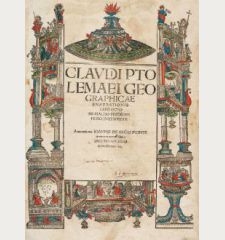
Claudii Ptolemaei Alexandrini Geographicae Enarrationis, Libri Octo ... Prostant...
Laurent Fries (*1485 - †1532)Reference 11191
Description
Ptolemy's Geographia with 50 Woodcut Maps by Laurent Fries.
A very fine wide-margin example of Ptolemy's Geographia with 50 large woodcut maps by Waldseemüller/Fries. This is the second edition by Servetus, printed in 1541.
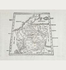
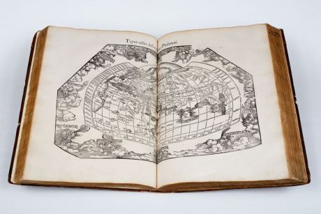
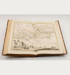
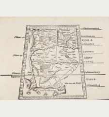
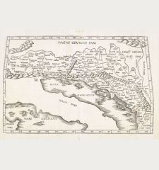
The impressive woodcut maps were created by Laurent Fries. In most cases he reduced the size of the equivalent map from the 1513 Waldseemüller edition. But Fries also prepare three new maps for his atlas: A map of Southeast Asia and the East Indies, one of China with Japan and a new world map. 27 maps go back to Ptolemaeus and show the geographical knowledge of the ancient world, 23 maps are modern and based on geographical information of the early 16th century. The woodblocks of these maps were first used by Laurent Fries in 1522. In total, four editions with these maps appeared, all printed from the same woodblocks.
A peculiarity of the 1541 edition is the missing text on verso of some modern maps. This is due to the action of Calvinism, especially since the text on verso of the Holy Land map provoked controversy. Many of the first three editions were burned, which led Servetus to abdicate on some text on verso. Nevertheless, Servetus was burnt at the stake in 1553, condemned by Calvin for his doctrinal heresies, although the text is originally from Pirckheimer.
Particularly noteworthy is Fries' newly created world map Orbis Typus Universalis with the geographical information from Waldseemüller's large world map of 1507. For the first time the name America is mentioned on a map in a Ptolemy atlas. The map of Southeast Asia and the map of China are the first individual maps of these regions ever printed. Also the famous map of the Atlantic Tabula terrae novae should not go unmentioned. The so-called Admiral's Map refers to the discoveries and voyages of Christopher Columbus. Servetus has appended a few remarkable words concerning the absurdity of putting the claims of Amerigo Vespucci in precedence to those of the real discoverer. He concludes his account of the discovery of America by Columbus on verso of the Admiral map with these words: - Toto itaque quod aiunt abberrant coelo qui hanc continentem Americam nuncupari contendunt, cum Americus multo post Columbum eandem terram adieret, nee cum Hispanis ille, sed cum Portugallensibus, ut suas merces commutaret, eo se contulit.
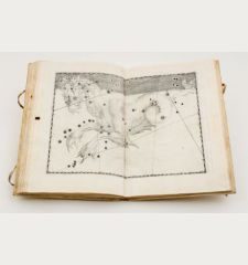
Among the woodcut illustrations in the text, the full-page armillary sphere by Albrecht Dürer (Meder 262) stands out. The authorship of Dürer is unquestionably solid at this sheet, since Johann Tscherte, the imperial architect in Vienna, has mentioned this armillary sphere in two letters to Pirkheimer as drawn by our mutual friend Albrecht Dürer. (Thausing, Dürer II p. 223).
The atlas is divided into three parts: First, the text comprising the new Latin translation by the humanist Wilibald Pirckheimer of the 1525 edition, which has been edited by Michael Servetus, for the first time for the 1535 edition and the second time for this 1541 edition. The second part has all the maps, and the third and last part consists of a comprehensive index.
All maps of this atlas can be seen in high resolution at our Atlas Gallery website: 1541 Ptolemy/Fries Atlas
Details
| Cartographer | Laurent Fries |
| Title | Claudii Ptolemaei Alexandrini Geographicae Enarrationis, Libri Octo ... Prostant Lugduni apud Hugonem a Porta. M. D. XLI. |
| Publisher, Year | G. Trechsel, Vienne, 1541 |
| Size | 40.5 x 29.0 cm (15.9 x 11.4 inches), Folio |
| Collation | 149 pages, 1 leaf, 48 leaves index |
| Illustrations | 49 double page woodcut maps, 1 full page woodcut map, serveral woodcuts in text, 2 full page woodcuts. |
| Cover | Calf binding |
| Volume | 3 parts in 1 volume |
| Reference | Shirley, R. W.: Maps in the Atlases of the British Library, T.PTOL 7g; Phillips, P.L.: A List of Geographical Atlases in the Library of Congress, #336; Sabin, J.: A Dictionary of books relating to America from its discovery to the present time, #66485 |
Condition
Contemporary brown calf gilt, most likely Italian. With small embossed gilt edges and gold embossed floral centerpiece. Rubbed, extremities worn, rebacked, corners restored, new front endpapers.
Partly slightly browned and stained, minor staining in upper magin on some leaves. Title page somewhat dust soiled and with small marginal defects. Title page marked with the ownership marks of the 16th and 17th Century. Gerardus Alectorius, 1586, head at the collegiate church in Bonn and registrar in Cologne; Haymonis Knippinck and Johannis Wendelini 1630.
All maps in beautiful, clear imprints. Overall a very good, complete copy with very wide margins. Even Dürer's armillary sphere is not cut, which usually is cropped.
Cartographer
Images to Download
If you like to download the image of this map with a resolution of 1200 pixels, please follow the link below.
You can use this image for publication on your personal or commercial websites for free if you set a link to this website. If you need photographs with a higher resolution, please contact us.
Atlases - Fries, Laurent - Claudii Ptolemaei Alexandrini Geographicae...

![Ch'onha Chido [Atlas of all under Heaven] Ch'onha Chido [Atlas of all under Heaven]](https://www.vintage-maps.com/3336-home_default/anonymous-korean-manuscript-atlas-chonha-chido-1820.jpg)
![Ch'onha Chido [Atlas of all under Heaven] Ch'onha Chido [Atlas of all under Heaven]](https://www.vintage-maps.com/4291-home_default/anonymous-korean-manuscript-atlas-chonha-chido-1800.jpg)
![Ch'onha chido [Atlas of all under Heaven] Ch'onha chido [Atlas of all under Heaven]](https://www.vintage-maps.com/3314-home_default/anonymous-korean-woodblock-atlas-chonha-chido-1750.jpg)
![Tabula nova Hispaniae [Tabula noua Hispaniae] Tabula nova Hispaniae [Tabula noua Hispaniae]](https://www.vintage-maps.com/3236-home_default/fries-spain-portugal-1541.jpg)
![[De Boemia. / Tabula quarta & quinta Europae de nonnullis / Germaniae ...] [De Boemia. / Tabula quarta & quinta Europae de nonnullis / Germaniae ...]](https://www.vintage-maps.com/2304-home_default/fries-germany-1541.jpg)
![[Tab. Mo. Primae Partis Aphricae et Tabula Secunde partis Aphricae.] [Tab. Mo. Primae Partis Aphricae et Tabula Secunde partis Aphricae.]](https://www.vintage-maps.com/3651-home_default/fries-north-africa-1525.jpg)
