Product successfully added to your shopping cart
There are 0 items in your cart. There is 1 item in your cart.
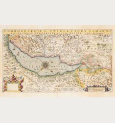
Lacus Lemani Vicinorumq. Locorum Nova et Accurata Descriptio
Abraham Ortelius (*1527 - †1598)Reference 12646
Description
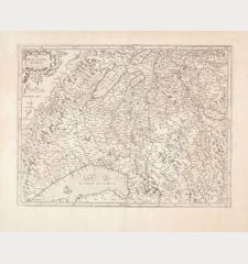
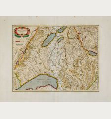
Rare and extremely decorative map of Lake Geneva by J. B. Vrients. Vrients used this map only in 3 editions of the Ortelius atlases he published between 1608 and 1612. According to Marcel Van den Broecke, only 925 copies were printed in total. Since only a small percentage of the maps survived the long time, the low edition accounts for the rarity of Vrients' map of Lake Geneva today. This example comes from the Latin edition of the Ortelius Atlas of 1609 or 1612.
The map shows Lake Geneva with Geneva (Genève) and Lausanne. Decorated with three cartouches, three sailing ships, a sea monster and a mileage scale. Latin text on verso.
Details
| Cartographer | Abraham Ortelius |
| Title | Lacus Lemani Vicinorumq. Locorum Nova et Accurata Descriptio |
| Publisher, Year | J. B. Vrients, Antwerp, 1609 or 1612 |
| Plate Size | 37.0 x 50.8 cm (14.6 x 20.0 inches) |
| Sheet Size | 44.0 x 55.0 cm (17.3 x 21.7 inches) |
| Reference | Van den Broecke, M.: Ortelius Atlas Maps, No. 55; Van der Krogt, P.: Koeman's Atlantes Neerlandici, 4985:31. |
Condition
Cartographer
Images to Download
If you like to download the image of this map with a resolution of 1200 pixels, please follow the link below.
You can use this image for publication on your personal or commercial websites for free if you set a link to this website. If you need photographs with a higher resolution, please contact us.
Switzerland - Ortelius, Abraham - Lacus Lemani Vicinorumq. Locorum Nova et...


![[Nova Helvetiae tabula geographica] [Nova Helvetiae tabula geographica]](https://www.vintage-maps.com/3425-home_default/scheuchzer-switzerland-lake-geneva-1720.jpg)



![[ohne Titel] [ohne Titel]](https://www.vintage-maps.com/1915-home_default/muenster-switzerland-fribourg-freiburg-im-ueechtland-1574.jpg)
![[Neuwnburger See] [Neuwnburger See]](https://www.vintage-maps.com/1642-home_default/muenster-switzerland-lake-neuchatel-lac-de-neuchatel-1574.jpg)
