Product successfully added to your shopping cart
There are 0 items in your cart. There is 1 item in your cart.
Total products
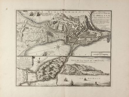
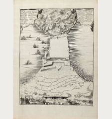
Nouveau Plan de la Ville de Gibraltar / Plan de la Ville de Ceuta / Veue de la Ville de...
Nicolas de Fer (*1646 - †1720)Antique map of Ceuta, Gibraltar. Printed in Amsterdam by G. Danet in 1727.
Reference 11071
Description
Rare, decorative map of Gibraltar and Ceuta by Nicolas de Fer. Showing the battle around Gibraltar during the Anglo-Spanish War in 1727. In the upper part a view of Gibraltar with a city map, at bottom left a plan of Ceuta and on the right a coastal view of Gibraltar with sailing ships in foreground. Engraved by A. Coquart.
Details
| Cartographer | Nicolas de Fer |
| Title | Nouveau Plan de la Ville de Gibraltar / Plan de la Ville de Ceuta / Veue de la Ville de Gibraltar |
| Publisher, Year | G. Danet, Amsterdam, 1727 |
| Plate Size | 39.2 x 48.8 cm (15.4 x 19.2 inches) |
| Sheet Size | 53.0 x 67.5 cm (20.9 x 26.6 inches) |
Condition
Excellent conditions with wide margin
Cartographer
Nicolas de Fer was born in 1646 and was an important French geographer and cartographer of the late 17th Century. He issued more than 600 separate maps and was appointed Geographer of the King. He died in 1720.
Images to Download
If you like to download the image of this map with a resolution of 1200 pixels, please follow the link below.
You can use this image for publication on your personal or commercial websites for free if you set a link to this website. If you need photographs with a higher resolution, please contact us.
Nicolas de Fer: Nouveau Plan de la Ville de Gibraltar / Plan de la Ville de Ceuta / Veue de la Ville de Gibraltar.
Antique map of Ceuta, Gibraltar. Printed in Amsterdam by G. Danet in 1727.
Spain - Portugal - Fer, Nicolas de - Nouveau Plan de la Ville de Gibraltar /...

![Tabula nova Hispaniae [Tabula noua Hispaniae] Tabula nova Hispaniae [Tabula noua Hispaniae]](https://www.vintage-maps.com/3236-home_default/fries-spain-portugal-1541.jpg)


![[Canary Islands] [Canary Islands]](https://www.vintage-maps.com/3021-home_default/bordone-spain-portugal-canaries-tenerife-gran-canaria.jpg)


