Product successfully added to your shopping cart
There are 0 items in your cart. There is 1 item in your cart.
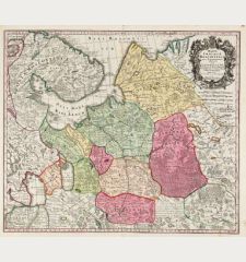
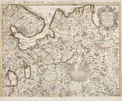
Carte de Moscovie. Dressee par Guillaume De l'Isle...
Guillaume de l'Isle (*1675 - †1726)Reference 12458
Description
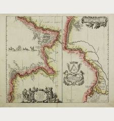
Large, old coloured map of the western part of Russia by Guillaume de l'Isle. The map is printed on two sheets, below size is for one sheet each. If joined, the size of the map is 97cm x 62cm. This is the Covens & Mortiers edition of the richly detailed map by G. de l'Isle. It shows the area from Murmansk in the northwest, the White Sea, Lake Onega, Lake Ladoga with St. Petersburg, up to the Pechora River in the northeast. In the southeast, the map reaches the northern tip of the Caspian Sea. A beautiful title cartouche to the upper right.
Details
| Cartographer | Guillaume de l'Isle |
| Title | Carte de Moscovie. Dressee par Guillaume De l'Isle... |
| Publisher, Year | Covens & Mortier, Amsterdam, circa 1730 |
| Plate Size | 49.0 x 61.5 cm (19.3 x 24.2 inches) |
| Sheet Size | 53.0 x 63.0 cm (20.9 x 24.8 inches) |
Condition
Cartographer
Images to Download
If you like to download the image of this map with a resolution of 1200 pixels, please follow the link below.
You can use this image for publication on your personal or commercial websites for free if you set a link to this website. If you need photographs with a higher resolution, please contact us.
Russia - de l'Isle, Guillaume - Carte de Moscovie. Dressee par Guillaume...

![Verus Chersonesi Tauricae Seu Crimea Conspectus ... [and] Theatrum Belli Ao MDCCXXXVII ... [and] Explicatio Duarum Tabularum... Verus Chersonesi Tauricae Seu Crimea Conspectus ... [and] Theatrum Belli Ao MDCCXXXVII ... [and] Explicatio Duarum Tabularum...](https://www.vintage-maps.com/2205-home_default/du-chaffat-ukraine-russo-turkish-war-crimea-1740.jpg)
