Product successfully added to your shopping cart
There are 0 items in your cart. There is 1 item in your cart.
Total products

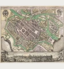
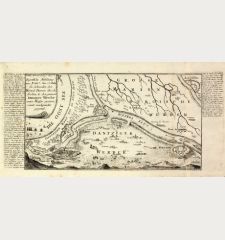
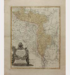
Prospect, Grundris und Gegend der Polnischen vesten Reichs und Handels-Stadt Dantzig...
Johann Baptist Homann (*1664 - †1724)Old coloured city plan of Gdansk, Danzig. Printed in Nuremberg by J. B. Homann circa 1730.
Reference 12676
Description
Old coloured map of the surroundings of Gdańsk (Danzig) by Johann Baptist Homann. Above left, the Baltic Sea with Gdansk Bay (Zatoka Gdańska) and the mouth of the Vistula, extending south to Tczew (Dirschau). Below, the view of the city of Gdańsk flanked by merchants at the harbour and an allegory with a celestial map and a globe.
Details
| Cartographer | Johann Baptist Homann |
| Title | Prospect, Grundris und Gegend der Polnischen vesten Reichs und Handels-Stadt Dantzig und ihrem Werder |
| Publisher, Year | J. B. Homann, Nuremberg, circa 1730 |
| Plate Size | 48.7 x 56.6 cm (19.2 x 22.3 inches) |
| Sheet Size | 52.8 x 63.0 cm (20.8 x 24.8 inches) |
| Reference | Sandler, C.: Johann Baptista Homann, Die Homännischen Erben, Matthäus Seutter und Ihre Landkarten, p. 61, No. 188 |
Condition
Centrefold backed at the bottom. Very good condition.
Cartographer
Johann Baptist Homann was born 1664 in Oberkammlach. He founded his business 1702 in Nuremberg, Germany. After a long period of Dutch domination in map publishing, the Homann publishing house became the most important map and atlas producer in Germany. He became a member of the Academy of Science in Berlin just after he published his first atlas in 1707. After his death 1724 in Nuremberg, the company was continued by his son Johann Christoph. The publishing firm was bequeathed to his heirs after his death in 1730 and was traded under the name Homann Heirs until the next century.
Images to Download
If you like to download the image of this map with a resolution of 1200 pixels, please follow the link below.
You can use this image for publication on your personal or commercial websites for free if you set a link to this website. If you need photographs with a higher resolution, please contact us.
Johann Baptist Homann: Prospect, Grundris und Gegend der Polnischen vesten Reichs und Handels-Stadt Dantzig und ihrem Werder.
Old coloured city plan of Gdansk, Danzig. Printed in Nuremberg by J. B. Homann circa 1730.
Poland - Homann, Johann Baptist - Prospect, Grundris und Gegend der...

