Product successfully added to your shopping cart
There are 0 items in your cart. There is 1 item in your cart.
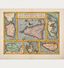
Siciliae Veteris Typus ...
Abraham Ortelius (*1527 - †1598)Reference 12688
Description
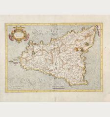
One of the most beautiful maps of Sicily ever printed.
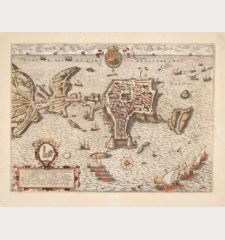
A striking example of Ortelius' map of Sicily. Showing the Mediterranean island of Sicily (Sicilia) with three cartouches and rich decoration. With numerous sailing ships and sea monsters. Lower left a cartouche with places of ancient Sicily, upper left an inset map of Syracuse. At the top centre the beautiful title cartouche. Cartographically the map is based on Gastaldi's 1545 map of Sicily and was first published in 1584. The present example comes from the Latin edition of the Parergon of 1624. Latin text on the verso.
Details
| Cartographer | Abraham Ortelius |
| Title | Siciliae Veteris Typus ... |
| Publisher, Year | Balthasar Moretus, Antwerp, 1584 [1624] |
| Plate Size | 37.3 x 48.6 cm (14.7 x 19.1 inches) |
| Sheet Size | 48.3 x 55.5 cm (19.0 x 21.9 inches) |
| Reference | Van den Broecke, M.: Ortelius Atlas Maps, No. 211; Van der Krogt, P.: Koeman's Atlantes Neerlandici, 7510H:31 |
Condition
Cartographer
Images to Download
If you like to download the image of this map with a resolution of 1200 pixels, please follow the link below.
You can use this image for publication on your personal or commercial websites for free if you set a link to this website. If you need photographs with a higher resolution, please contact us.

![Abraham Ortelius: Siciliae Veteris Typus ... Antique Maps, Ortelius, Italy, Sicily (Sicilia), 1584 [1624]: Siciliae Veteris Typus ...](https://www.vintage-maps.com/3931-large_default/ortelius-italy-sicily-sicilia-1584-1624.jpg)


![[Sardigna, Sardinia, Sardegna] [Sardigna, Sardinia, Sardegna]](https://www.vintage-maps.com/2947-home_default/bordone-italy-sardinia-sardegna-1528-1565.jpg)
