Product successfully added to your shopping cart
There are 0 items in your cart. There is 1 item in your cart.
Total products
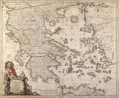
Exactissima Totius Archipelagi nec non Graeciae Tabula in qua Omnes Subjacentes...
Nicolas Visscher (*1618 - †1679)Coloured map of Crete, Aegean, Peloponnese. Printed in Amsterdam circa 1680.
Reference 10551
Description
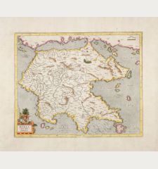
Visscher's map of Greece with the Greek Islands, Crete, part of Asia Minor and the Aegean Sea. Original old coloured cartouche with outline colour on the map.
Details
| Cartographer | Nicolas Visscher |
| Title | Exactissima Totius Archipelagi nec non Graeciae Tabula in qua Omnes Subjacentes Regiones et Insulae distincte ostenduntur par Nicolaum Visscher |
| Publisher, Year | Amsterdam, circa 1680 |
| Plate Size | 46.5 x 56.5 cm (18.3 x 22.2 inches) |
| Sheet Size | 48.0 x 57.7 cm (18.9 x 22.7 inches) |
| Reference | Zacharakis, C.G.: A Catalogue of Printed Maps of Greece, 1477-1800, No. 3627/2350. |
Condition
Several tears and small holes backed, some losses in margin, vertical crease left to centrefold, some waterstains, complete margin backed from former framing. Condition is average.
Cartographer
The Visscher family were art and map dealers in Amsterdam during the 17th century. Funded by C. J. Visscher (1587-1652), the business was continued by his son and grandson both named Nicolas. Nicolas Visscher I was born 1618 in Wenns, Austria. He died 1679 in Linz. After the death of Nicolas II, his widow passed the business to Pieter Schenk.
Images to Download
If you like to download the image of this map with a resolution of 1200 pixels, please follow the link below.
You can use this image for publication on your personal or commercial websites for free if you set a link to this website. If you need photographs with a higher resolution, please contact us.
Nicolas Visscher: Exactissima Totius Archipelagi nec non Graeciae Tabula in qua Omnes Subjacentes Regiones et Insulae distincte ostenduntur....
Coloured map of Crete, Aegean, Peloponnese. Printed in Amsterdam circa 1680.
Greece - Visscher, Nicolas - Exactissima Totius Archipelagi nec non...


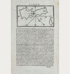
![[Candia, Crete, Karpathos] [Candia, Crete, Karpathos]](https://www.vintage-maps.com/2939-home_default/bordone-greece-crete-and-karpathos-1528-1565.jpg)
![[Euboea, Negroponte, Bosporus, Istanbul] [Euboea, Negroponte, Bosporus, Istanbul]](https://www.vintage-maps.com/2937-home_default/bordone-greece-negroponte-euboea-1528-1565.jpg)
