Product successfully added to your shopping cart
There are 0 items in your cart. There is 1 item in your cart.
Total products
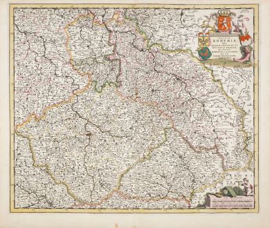
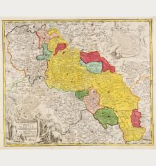
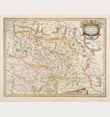
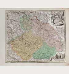
Regnum Bohemia eique Annexae Provinciae, ut Ducatus Silesia...
Frederick de Wit (*1630 - †1706)Old coloured map of Czechia - Bohemia. Printed in Amsterdam by Frederick de Wit circa 1680.
Reference 12460
Description
Old coloured antique map of Bohemia with Silesia and Moravia by Frederick de Wit. Shows the area between Frankfurt an der Oder and Bavaria in the southwest and Ratibor (Racibórz) in the east. With Prague, Wrocław (Breslau ) and Świdnica (Schweidnitz). Decorated with a beautiful title cartouche with coat of arms.
Details
| Cartographer | Frederick de Wit |
| Title | Regnum Bohemia eique Annexae Provinciae, ut Ducatus Silesia... |
| Publisher, Year | Frederick de Wit, Amsterdam, circa 1680 |
| Plate Size | 48.2 x 57.3 cm (19.0 x 22.6 inches) |
| Sheet Size | 53.0 x 63.0 cm (20.9 x 24.8 inches) |
Condition
Very good condition with old colour. Never framed before.
Cartographer
Frederick de Wit, born 1630 in Amsterdam, was a famous engraver and publisher in Amsterdam. He acquired many of the printing plates of Blaeu and Janssonius when it came to auction. His map were very popular because of the quality of the engravings and the beautiful colouring. After his death in 1706, his work was re-issued by Pieter Mortier and Covens & Mortier.
Images to Download
If you like to download the image of this map with a resolution of 1200 pixels, please follow the link below.
You can use this image for publication on your personal or commercial websites for free if you set a link to this website. If you need photographs with a higher resolution, please contact us.
Frederick de Wit: Regnum Bohemia eique Annexae Provinciae, ut Ducatus Silesia....
Old coloured map of Czechia - Bohemia. Printed in Amsterdam by Frederick de Wit circa 1680.
Czechia - Bohemia - Wit, Frederick de - Regnum Bohemia eique Annexae Provinciae,...


