Product successfully added to your shopping cart
There are 0 items in your cart. There is 1 item in your cart.
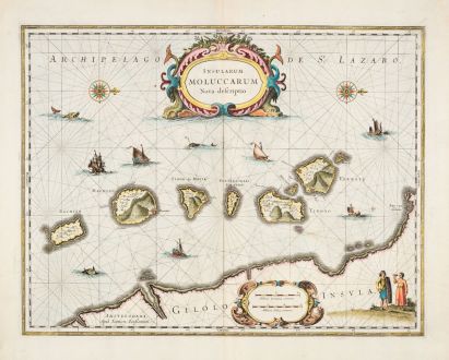
Insularum Moluccarum Nova Descriptio.
Johannes Janssonius (*1588 - †1664)Reference 12869
Description
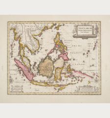
This beautiful map shows the famed Spice Islands, crucial to the Dutch trading empire in the East Indies during the 17th Century. It shows the Indonesian archipelago of the Moluccas between Sulawesi and New Guinea. Akin to Blaeu's map, it goes a step further by encompassing the southern island of Bachian. This example is the earliest edition of the map and comes from the French edition of the Mercator-Hondius Atlas printed in 1633.
The map's charm lies in its ornate details, featuring an elaborate title cartouche supported by two sea monsters. Another cartouche displays the scale of miles. The map is adorned with various sailing vessels, sea monsters, and two intricate compass roses, with the north oriented to the right. Additionally, a native couple is depicted, showcasing the costumes and weapons characteristic of the region. This map not only captures geographical nuances but also offers a glimpse into the cultural richness of the Spice Islands during the early 17th century.
Details
| Cartographer | Johannes Janssonius |
| Title | Insularum Moluccarum Nova Descriptio. |
| Publisher, Year | Janssonius, Amsterdam, 1633 |
| Plate Size | 38.0 x 49.2 cm (15.0 x 19.4 inches) |
| Sheet Size | 48.0 x 56.2 cm (18.9 x 22.1 inches) |
| Reference | Van der Krogt, P.: Koeman's Atlantes Neerlandici, 8560:1. |
Condition
Cartographer
Images to Download
If you like to download the image of this map with a resolution of 1200 pixels, please follow the link below.
You can use this image for publication on your personal or commercial websites for free if you set a link to this website. If you need photographs with a higher resolution, please contact us.
Southeast Asia - Janssonius, Johannes - Insularum Moluccarum Nova Descriptio.

![[Maidegascar, Zanzibar, Scorsia, Inebila, Imangla, Scilam, Dondina] [Maidegascar, Zanzibar, Scorsia, Inebila, Imangla, Scilam, Dondina]](https://www.vintage-maps.com/2957-home_default/bordone-east-africa-madagascar-sri-lanka-1528-1565.jpg)
![[Java Minore] [Java Minore]](https://www.vintage-maps.com/2959-home_default/bordone-southeast-asia-indonesia-sumatra-thailand-borneo.jpg)
