Product successfully added to your shopping cart
There are 0 items in your cart. There is 1 item in your cart.
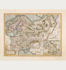
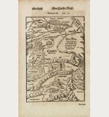
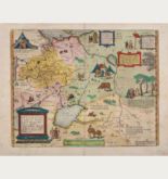
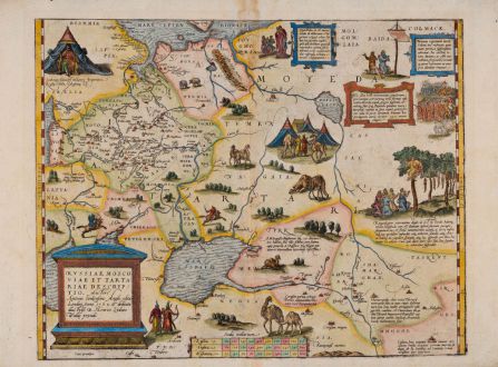
Russiae, Moscoviae et Tartariae Descriptio. Auctore Antonio Ienkensono Anglo, Edita...
Abraham Ortelius (*1527 - †1598)Reference 12411
Description
From the first edition of the Ortelius Atlas of 1570.
The rare first edition of Ortelius' map of Russia. From the 1570 Latin edition of Theatrum Orbis Terrarum published by Gielis Coppens van Diest. Only around 100 maps have been printed for this edition. This first edition can be identified by the text on verso. The page number is 46 and the last line has the full width. (Van den Broecke)
Shows the region from the Baltic Sea, Lithuania and the Black Sea to the Sur River, Tashkent, the Kossack Regions and Colmack. Based on the map of the English merchant and adventurer, Anthony Jenkinson from the year 1562. With comprehensive descriptions, illustrations of Cossacks, camels, camps, armies and a strange grave scene where dead people hanging in trees. In the upper left corner Ivan the Terrible perched in front of his tent. Latin text on verso.
Details
| Cartographer | Abraham Ortelius |
| Title | Russiae, Moscoviae et Tartariae Descriptio. Auctore Antonio Ienkensono Anglo, Edita Londini Anno 1562 ... |
| Publisher, Year | Gielis Coppens van Diest, Antwerp, 1570 |
| Plate Size | 35.2 x 44.8 cm (13.9 x 17.6 inches) |
| Sheet Size | 39.0 x 52.8 cm (15.4 x 20.8 inches) |
| Reference | Van den Broecke, M.: Ortelius Atlas Maps, No. 162 1570L(A); Van der Krogt, P.: Koeman's Atlantes Neerlandici, 1800:31:001 |
Condition
Cartographer
Images to Download
If you like to download the image of this map with a resolution of 1200 pixels, please follow the link below.
You can use this image for publication on your personal or commercial websites for free if you set a link to this website. If you need photographs with a higher resolution, please contact us.
Russia - Ortelius, Abraham - Russiae, Moscoviae et Tartariae...

![Verus Chersonesi Tauricae Seu Crimea Conspectus ... [and] Theatrum Belli Ao MDCCXXXVII ... [and] Explicatio Duarum Tabularum... Verus Chersonesi Tauricae Seu Crimea Conspectus ... [and] Theatrum Belli Ao MDCCXXXVII ... [and] Explicatio Duarum Tabularum...](https://www.vintage-maps.com/2205-home_default/du-chaffat-ukraine-russo-turkish-war-crimea-1740.jpg)

