Product successfully added to your shopping cart
There are 0 items in your cart. There is 1 item in your cart.
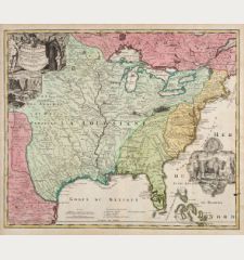
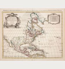
L'America Settentrionale. Nuovamente Corretta et Accresciuta Secondo le Relationi Piu...
Giovanni Giacomo Rossi (*1627 - †1691)Reference 12415
Description
First state of the rare map of North America by G. G. de Rossi after G. Sanson. California is shown as an island. Based on the map of Sanson from 1669. It includes a few additions to Sanson's map such as Iceland, the British Isles and the recurrence of C Blanco on the California coast line. The island of California is depicted in the Foxe form of 1635. This is the first state of the map, dated 1677 in the cartouche. In a later state the western part of the Great Lakes is closed. From de Rossi's Atlas Mercurio Geographico. Engraved by Giorgio Widman.
Details
| Cartographer | Giovanni Giacomo Rossi |
| Title | L'America Settentrionale. Nuovamente Corretta et Accresciuta Secondo le Relationi Piu Moderne da Guglielmo Sansone... |
| Publisher, Year | G. G. de Rossi, Rome, 1677 |
| Plate Size | 39.2 x 54.3 cm (15.4 x 21.4 inches) |
| Sheet Size | 48.0 x 59.4 cm (18.9 x 23.4 inches) |
| Reference | Burden, P.D.: The Mapping of North America No. 491, state 1; McLaughlin, G. & Mayo, N.H.: The Mapping of California as an Island: An Illustrated Checklist, No. 65 |
Condition
Cartographer
Images to Download
If you like to download the image of this map with a resolution of 1200 pixels, please follow the link below.
You can use this image for publication on your personal or commercial websites for free if you set a link to this website. If you need photographs with a higher resolution, please contact us.
North America - Rossi, Giovanni Giacomo - L'America Settentrionale. Nuovamente...


